
The REED Center: A History of the Land
This ongoing research project explores the deep and evolving history of the land now home to The REED Center for Ecosystem Reintegration. Nestled against South Mountain, part of the Catoctin Mountain range in Frederick County, Maryland, the land’s story stretches back hundreds—if not thousands—of years. From Indigenous trail systems and early contact migrations to German frontier settlements and multi-generational farming, this land holds layers of memory and meaning.
We are compiling findings from historical land records, academic publications, archaeological clues, and oral histories. This project is a work in progress and will continue to grow as more evidence comes to light.
Timeline Embed (maybe)
https://timeline.knightlab.com/#make
I. Indigenous Presence and the Tuscarora Trail (Pre-1700s)
Long before colonial maps drew borders across the region, South Mountain was part of a vast and dynamic Indigenous landscape. Evidence suggests the Middletown Valley and adjacent ridgelines were used seasonally and strategically by multiple Native nations, including the Susquehannock, Lenape (Delaware), and later the Tuscarora.
The Tuscarora, originally from the Carolinas, began migrating northward after the Tuscarora War (1711–1715). By 1713, they were moving along what some sources refer to as "Tuscarora trails," informal pathways running from Virginia into Pennsylvania and beyond. These trails likely passed through or near present-day Frederick County, following high ground such as South Mountain.
While no formal village sites have been documented directly on The REED Center’s current land, regional scholarship—including the work of Dr. Stephen Feeley—confirms that Native peoples moved through this area and left behind traces in the landscape. Artifacts, place names, and path alignments offer clues to their continued presence and adaptation throughout the early 18th century.
(Feeley, Tuscarora Trails.)
II. Colonial Encroachment and German Settlement (1700s–1770s)
European colonization of western Maryland accelerated in the mid-1700s. The land surrounding South Mountain became a frontier zone, often described as a buffer between Indigenous territories to the west and English plantations to the east. German immigrants, many fleeing religious persecution and war in Europe, were among the first to settle the area in large numbers.
By the 1750s, families had established homesteads, churches, and small mills. They built log cabins and cleared fields on land that was often never formally ceded by Native peoples. The earliest surveys of land in what would become Frederick County show irregular and overlapping claims, many of them on or near natural springs and ridgelines.
This was a time of both conflict and cooperation. Some German settlers relied on Native trade networks and knowledge of the terrain. Others participated in militia raids or lobbied for more permanent colonial presence. As land patents became more regularized in the 1760s and 1770s, larger tracts began to take on family names and become permanent holdings.
III. Stone and Soil: Anchoring Legacy on South Mountain (1780s–1820s)
The post-Revolutionary War period brought stability and prosperity to parts of western Maryland. It was during this era that stone homes began replacing earlier log dwellings, and multigenerational farms became the norm.
According to local lore and early architectural evidence, one of the original stone homes on the property was built in the 1780s or 1790s. These homes signaled permanence—a shift from survival to rootedness. Families who built them often did so to confirm their status as legal landholders under the new American system.
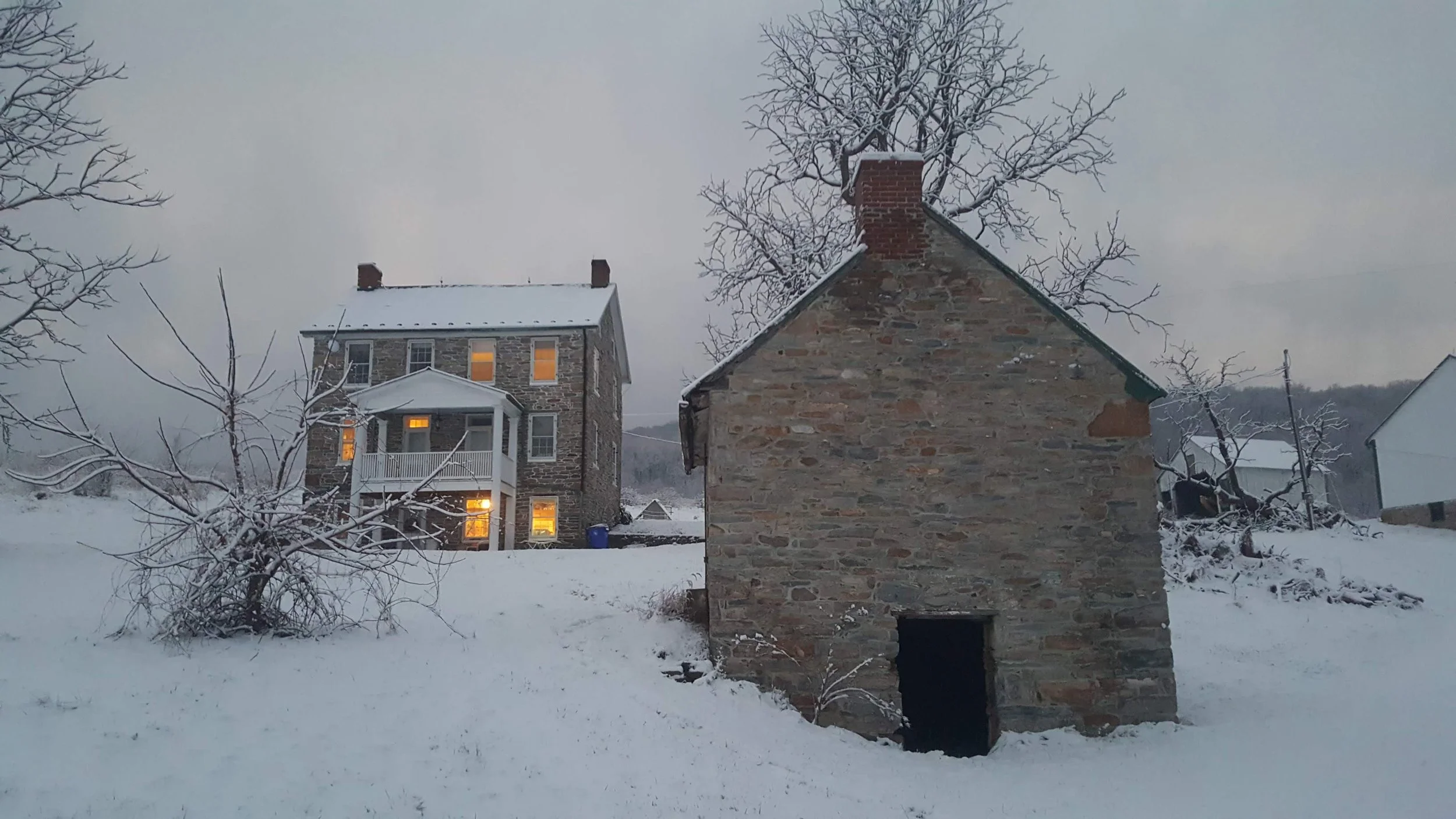
Just a few decades later, around 1820, another home was built close to the road—what we now refer to as the "blue farmhouse." This house, just feet from the old wagon route that once crossed the property, would become the core of the Reed family’s legacy. Oral history suggests that at least three generations of the Reed family women were raised in that house, including the late Mrs. Reed, who passed away around 2018.
This structure may have served not only as a home, but as a witness to the agricultural rhythms, family milestones, and ecological changes of nearly two centuries.
IV. A Working Landscape: The 19th and 20th Centuries (1820s–1990s)
[Section forthcoming] - Could be broken into two sections
This section will explore the transformation of the property into a diversified farm, orchard, and woodland throughout the 19th and 20th centuries. Topics will include land inheritance patterns, New Deal-era agricultural changes, and the continuity of local knowledge passed down through the Reed family.
V. Conservation, Reintegration, and Future Stewardship (1990s–Present)
[Section forthcoming]
This final section will focus on the recent transition of the property into The REED Center for Ecosystem Reintegration, and its current role as a living classroom, food forest, and ecological demonstration site.
Contribute to the Story
If you have documents, photographs, oral histories, or family stories related to South Mountain, Middletown Valley, or the Reed family, we’d love to hear from you. This is a collaborative historical project, and all insights are welcome.
Bibliography
Feeley, Stephen Delbert. Tuscarora Trails: Indian Migrations, War, and Constructions of Colonial Frontiers. 2 vols. PhD diss., College of William and Mary, 2007.
Harper, Paris Deirdre. The Tuscarora Migration in 1713 and 2013: Re-enactment and Revitalization. MA thesis, University of Georgia, 2013.
Kessel, Elizabeth Augusta. Germans on the Maryland Frontier: A Social History of Frederick County, Maryland, 1730–1800. 2 vols. PhD diss., Rice University, 1981.
Tracey, Grace L., and John P. Dern. Pioneers of Old Monocacy: The Early Settlement of Frederick County, Maryland, 1721–1743. Baltimore: Genealogical Publishing Co., 1987; 2nd ed., 1989. Reprint, Clearfield, 1999.
[Anonymous]. Colonial Native Dispossession. Manuscript study, mid- to late-20th century.